Every community in America wants the same thing — an economy that rides high when times are good and rides things out when times are bad.
The recession tested the resilience of communities everywhere. Now, as the country recovers, communities are rethinking how to compete for the jobs and people needed to sustain a growing economy.
“The competition is about place — creating places where people want to be,” says Roger Millar, vice president of Smart Growth America.
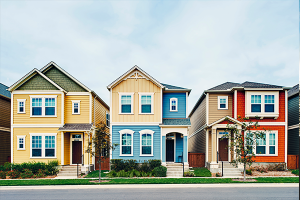
While different places appeal to different people, there’s a growing awareness that walkable neighborhoods with a wide mix of uses provide communities a trump card as they strive to compete in a 21st century economy.
Neighborhoods where people can live close to work, get their groceries and grab a beer — all without needing a car — are the magnets that attract many of today’s young professionals. Where they go, jobs follow.
“Millennials are moving to the places they want to live and then looking for work — and employers are chasing that talent,” Millar says.
A 2015 report from City Observatory supports Millar’s point. Between 2007-11, the city centers of the nation’s largest metro areas — traditional hubs of walkability and mixed use — experienced stronger average job growth than outlying areas for the first time in decades.
Job growth isn’t the only economic benefit linked to walkable/ mixed-use neighborhoods. A 2012 study of Washington, D.C., neighborhoods by the Brookings Institution found a strong positive relationship between walkability and economic vital signs like office, retail and residential rents, retail revenues and residential sales prices.
That’s terrific for large cities where walkable/mixed-use neighborhoods are deeply woven into the fabric of the community. But in the race for economic growth, many smaller cities, blue highway towns and suburbs of large cities aren’t firing on all cylinders because they never developed walkable/mixed-use neighborhoods or because they need to grow and improve the ones they have.
The good news is that communities can do something about it by taking a fresh look at how they manage and stimulate new development and redevelopment through zoning codes, design standards, traffic controls and other planning actions going forward — especially in their central business districts.
“You can’t control whether you are in the south or the north. You can’t control the weather. But you can control your built environment (and) create a public realm that is interesting and exciting,” Millar says.
There’s an app for that — or at least a good read for anyone wondering what walkable/mixed-use living looks like. “City Comforts,” a highly praised book detailing the characteristics of urban villages by Seattle broker and author David Sucher, distills the essential elements of walkable/mixed-use neighborhoods into three simple rules — all based on his belief that the relation between buildings and the sidewalk is paramount.
Rule one: Place buildings at the property line abutting the sidewalk. Rule two: Make sure windows and main entrances face the sidewalk. Rule three: Put parking lots below, above, behind or beside buildings — never in front.
“It’s not a new design by any means. It’s totally reverse engineering,” Sucher says. “If you want walkable urbanism, copy the way neighborhoods were built pre-World War II.”
Sucher’s three rules go to the core of what makes walkable/ mixed-use neighborhoods tick, but they can’t force developers to build something they don’t want to build or people to live where they don’t want to live or businesses to locate where they don’t want to locate.
“Ultimately, it depends on market demand. It can’t be imposed politically. People have to choose it,” Sucher says. “If people don’t choose it, you’re sunk.”
While many small communities are short on supply, there’s strong demand for walkable/mixed-use living beyond big cities, Millar says. With the price of urban living in big cities soaring, people are looking for less costly choices.
Rifle, Colo., applies form-based codes
Rifle, Colo., population 9,500, is gunning to be one of those choices. “We want to become a place where you can afford to live and afford to do business,” says Nathan Lindquist, planning director.
Rifle is located three hours west of Denver across the Rocky Mountains. The town has doubled in size over the last decade thanks to the region’s energy boom and attractive outdoor lifestyle and the town’s relatively affordable housing compared to other places in the region like Vail, Aspen and Glenwood Springs. However, it needs to attract new businesses to diversify its economy, Lindquist says.
“The jobs part is the hard part,” he says.
Like many small towns, Rifle — founded in 1882 — has a historic downtown with the bones to become the kind of walkable/mixed-use neighborhood that many people — and by extension employers — find attractive.
The town has primed the pump for development with a new form-based downtown zoning code that allows greater density and mix of uses, a downtown strategic plan that includes adding transit service and a new downtown park and library. The town also recruited a movie theater to build a multi-plex on municipal property downtown and converted an aging movie house into a new events center.
Rifle put out development pro formas for mixed-use projects on five “opportunity sites” where property owners are willing to sell. One deal has already been concluded involving a developer with plans for a housing/ retail/office project.
“This is what people want, and I see that realization dawning here more and more,” Lindquist says.
Rifle’s next move involves curing an ill plaguing many small towns. Main Street — in Rifle’s case Railroad Avenue — is actually a state highway. Designed to move high volumes of cars at relatively high rates of speed, state highways make it almost impossible to create a walkable/mixed-use neighborhood when they double as Main Street.
Recognizing the highway was a drag on downtown development, the state awarded Rifle control of the road — and $5.6 million that had been earmarked for maintenance — so it can be urbanized with continuous sidewalks, street trees and other pedestrian-friendly features.
Grand Rapids goes for greater density
Grand Rapids is Michigan’s second largest city with a population of 190,000. The city, a two-plus-hour drive west of Detroit, had not changed its zoning code in nearly 40 years when it adopted a new form-based ordinance in 2007. Based on a citywide master plan adopted five years earlier, the code “really prepared us well” to emerge from the recession on a roll, says Suzanne Schulz, planning director.
Produced with extensive community involvement, the plan and code allow greater density downtown and greater mixed use in the city’s neighborhoods than previously permitted.
“That’s what developers are building,” Schulz says. About 1,200 new multifamily housing units are on the drawing board or breaking ground downtown and in neighborhoods.
The city’s Downtown Development Authority recently awarded tax breaks to help developers build a new downtown concert venue, an adjacent 14-story apartment tower and a 13-story office tower — the latest in a series of projects transforming Grand Rapids into “a little Chicago,” Schulz says.
“Millennials are moving to Grand Rapids in droves because we’re getting enough density to be cool,” Schulz says. That and the fact “they love that we’re putting in bike lanes.”
All of that gives Grand Rapids a competitive economic edge, Schulz says.
“Quality of life matters to the companies that are here and the companies we want to attract,” she says. “When I talk to other places, companies are beside themselves because they’re committed to their community, but they can’t hire people to come there.”
Salisbury, Md., focuses on Main Street
Smart Growth America chose Salisbury, Md., population 33,000, as one of 18 communities to receive free technical assistance last year to pursue smart growth goals such as walkability and mixed use.
A two-day walkability workshop helped the eastern shore city identify ways to make downtown more inviting for pedestrians and cyclists — information Salisbury is incorporating into a broad effort to make downtown a more walkable and livable place.
“We are working on this at all levels,” says Jacob Day, city council president.
Salisbury completed a downtown revitalization plan in 2012 with the goal of adding 300 jobs, 500 housing units and 10,000 square feet of commercial space to downtown. Key elements include surplusing a sea of city-owned parking lots so they can be transformed into residential/retail/office developments and giving Main Street a makeover with uniform sidewalks, lighting, signs, benches and plantings.
Salisbury put out requests for proposals to develop three surplused parking lots and will start work this fall on an $8.5-million Main Street improvement project. To encourage development, the city is offering to waive water/sewer connections fees for downtown projects. The city helped launch trolley service between downtown and Salisbury University, sold an old downtown firehouse that is now a music venue and started third Friday and first Saturday events showcasing visual arts and performing arts in the downtown on a monthly basis.
Redwood City, Calif., comes alive
A decade ago, Redwood City, Calif., was a place without a pulse. “It was known as Deadwood City for a long time,” says Aaron Aknin, assistant city manager. “The downtown hadn’t seen much economic activity in decades (and) there were very few housing units.”
Things have changed dramatically since then as Redwood City, a city of 80,000 people 30 minutes south of San Francisco, is turning its downtown into a model of walkability and mixed use where jobs, housing, shopping and entertainment are all within a 10-minute stroll of each other.
One of the keys to the turnaround was to “recognize that downtown forms one big (neighborhood)” rather than segregated clusters of different uses, Aknin says.
The Downtown Precise Plan, adopted in 2011, introduced form-based zoning that allows office, housing and retail anywhere in downtown — with a few exceptions — as long as projects meet stringent but clear design requirements.
Along with gathering extensive public input, Redwood City completed a blanket environmental impact statement for the entire plan so developers don’t need to complete environmental reviews
for individual projects. “If they come up with a project that meets the plan, the approval process is relatively easy,” Aknin said.
Before adopting the plan, the city gave the downtown a jump start by leading a public-private partnership to build a multi-plex theater and by demolishing an annex to the historic San Mateo County Courthouse so it could create Courthouse Square, where hundreds of public events are held every year.
Hundreds of apartment units and several hundred thousand square feet of office space have been built in downtown Redwood City since the plan was adopted. The city scored a huge coup when Box, a cloud computing company, announced last year it was moving its headquarters — and 1,000 employees — to downtown Redwood City from neighboring Los Altos.
The fact that downtown Redwood City has a Caltrans train station was essential to Box because 400 of its employees commute from San Francisco. The availability of a large building site was also a must. But the company had one more question, Aknin says. “Is there a neighborhood around our office?”
After burying its Deadwood City image, Redwood City can emphatically answer, “Yes!”
Brad Broberg is a Seattle-based freelance writer specializing in business and development issues. His work appears regularly in the Puget Sound Business Journal and the Seattle Daily Journal of Commerce.

